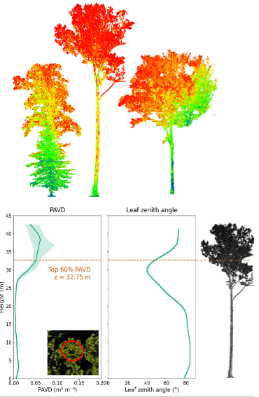
Tree Crown Architecture from Terrestrial LiDAR
This ongoing NSF-funded project quantified 3D tree crown architecture from terrestiral LiDAR and linked them to photosynthesis and leaf nutrients derived from hyperspectal imagery. Presentation can be found here.

Tree Crown Architecture from Airborne LiDAR
This NSF-funded project extracted key tree crown architectural metrics from airborne LiDAR and linked them to tree crown photosynthesis quantified from concurrent imaging spectroscopy. Presentation can be found here.

Weighted Overlay Model
This project developed a weighted overlay model to identify optimal black bear habitat in a conservation project in the Appalachian region.
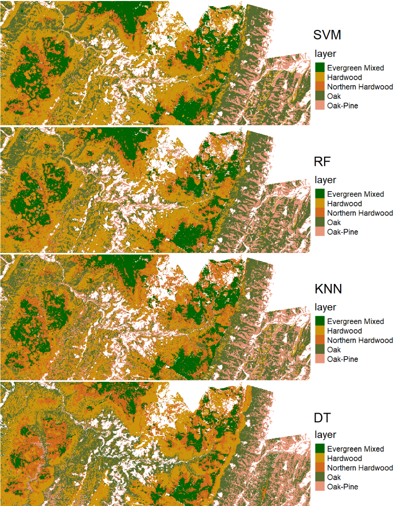
Forest Type Classification with Machine Learning
This project explored and compared forest type classification with four machine learning methods – Support Vector Machines (SVMs), Random Forest (RF), K-Nearest Neighbors (KNN), and Decision Tree (DT).
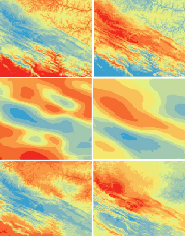
Modeling Climate Surface
This project modeled mean annual precipitation and temperature in the central Appalachian region using global polynomial interpolation (GPI), univariate linear regression, ordinary Kriging (OK), and empirical Bayesian Kriging (EBK) regression, and made quantitative and spatially-explicit evaluations of each outcome.

Landfill Site Suitability Model
This project developed a GIS-based multi-criteria decision analysis (MCDA) model for identifying optimal landfill locations in Monongalia County, WV.
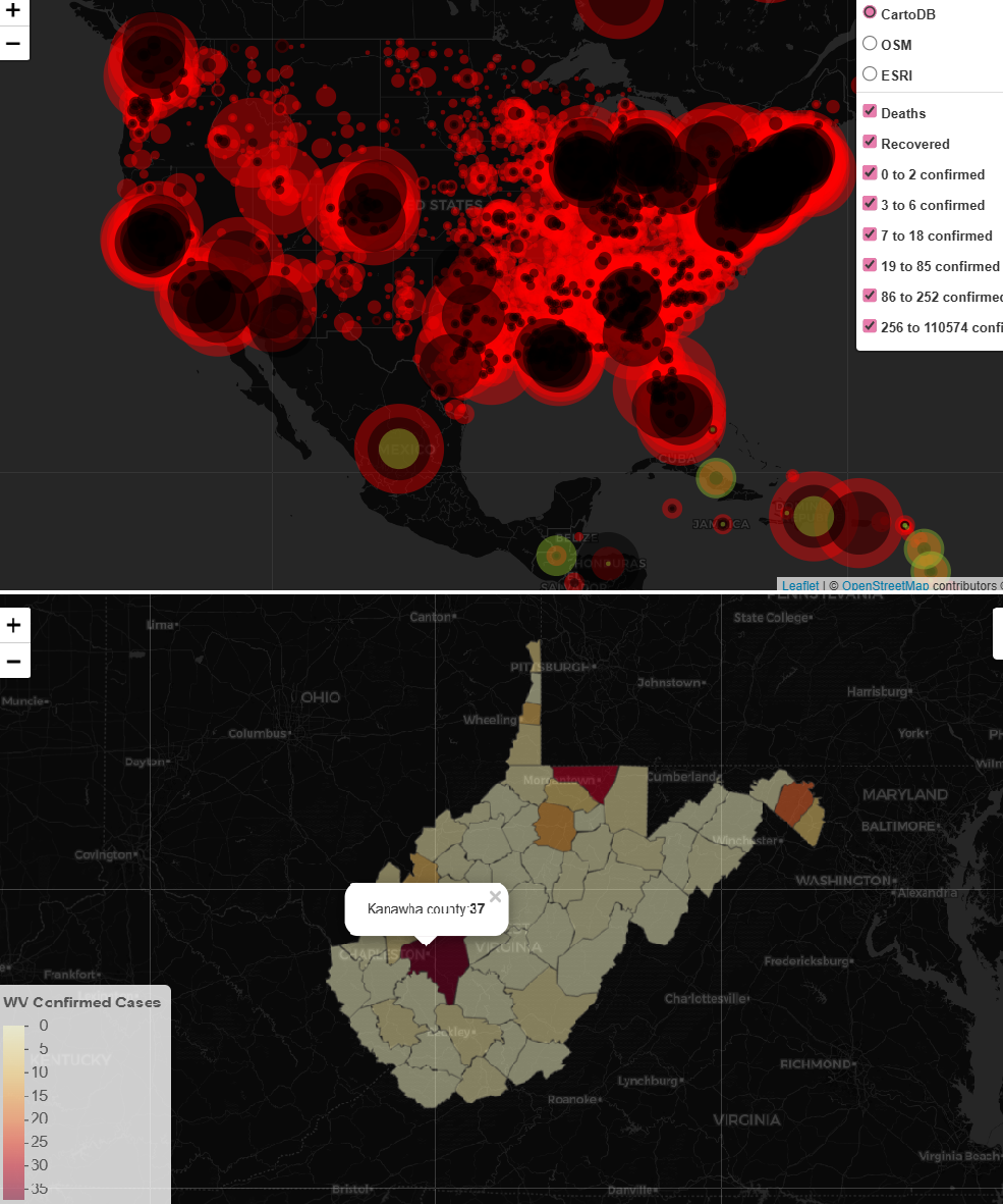
Interactive Map with Leaflet
An interactive webmap that displays COVID-19 world cases and their density (via point size), with filters to show only locations within a specified case range. Also an interactive map that displays cases for each county in OH, WV, PA, VA, and MD upon clicking.