Past and ongoing projects are displayed in reverse chronological order.
01
Why do trees look the way they are?
2025 – present
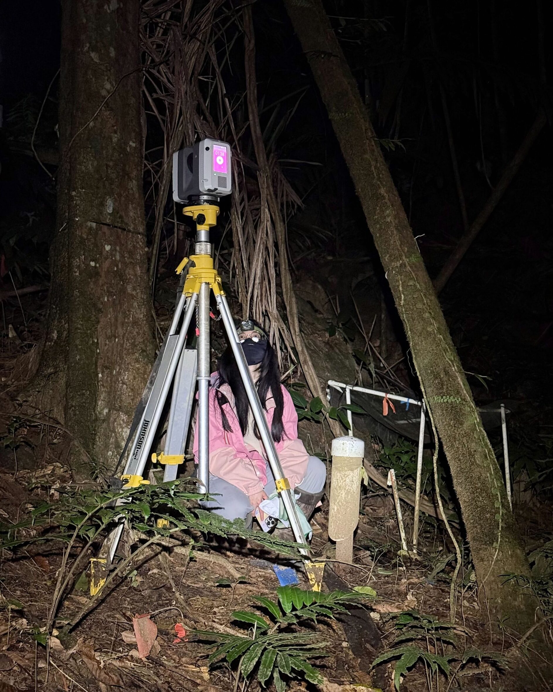
Used terrestrial laser scanning (TLS) to build detailed 3D reconstructions of tree architecture for naturally occurring trees across forest sites. This project quantifies high-fidelity leaf arrangement, including leaf angle, clumping, and crown density. The project aims to reveal how leaf arrangement impacts light absorption and spectral signals retrieved from concurrent hyperspectral imagery, and how it emerges from competition, environment, and evolutionary history. The project is funded by NSF. Check out the interim result here.
02
Tree crown architecture in a rainforest
2025 – present
As part of a DOE-funded MACROCOSM project, we conducted a terrestrial laser scanning field campaign near the El Yunque forest in Puerto Rico. The data will be used to understand tropical tree crown architecture, its day-night variability, and its response to drought.
03
Tree crown architecture from airborne LiDAR
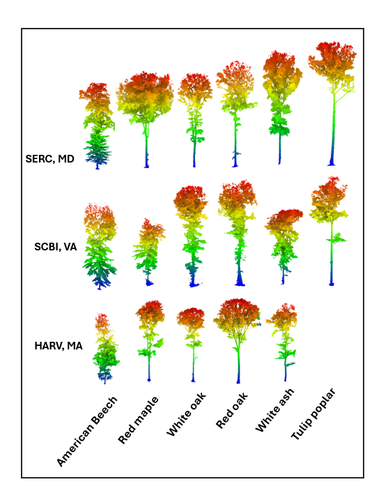
2022 – 2024
As part of an NSF-funded project, this project measured and tested whether the individual tree crown architecture and productivity of naturally occurring broadleaf deciduous trees differ across species and a wide environmental gradient using airborne LiDAR, imaging spectroscopy, and time-lapse camera measurements from eleven National Ecological Observatory Network (NEON) forests.
04
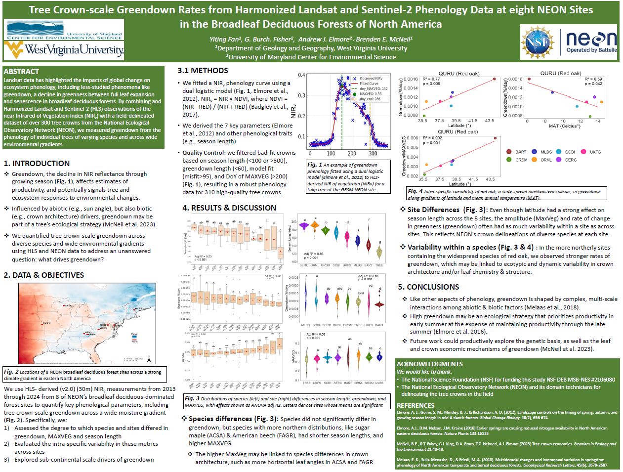
Tree phenology from Harmonized Landsat and Sentinel-2 phenology data
2021 – present
Mapped tree crown-scale greenness phenology across eight NEON broadleaf deciduous forest sites using Harmonized Landsat and Sentinel-2 (HLS) imagery. This project combined HLS-derived near-infrared reflectance time series, field-delineated tree crowns, and dual logistic phenology modeling to quantify greendown rate (the speed at which seasonal vegetation loses its green color and enters autumn dormancy), season length, and peak vegetation greenness across species and climate gradients, revealing how tree-level canopy dynamics vary across eastern North American forests.
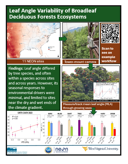
04
Leaf angle of broadleaf deciduous trees
2021 – 2024
As part of an NSF-funded project, this project measured and tested whether the sunlit leaf angle of broadleaf deciduous trees differs across species, environments, and time using three years of time-lapse camera measurements from eleven National Ecological Observatory Network (NEON) forests.
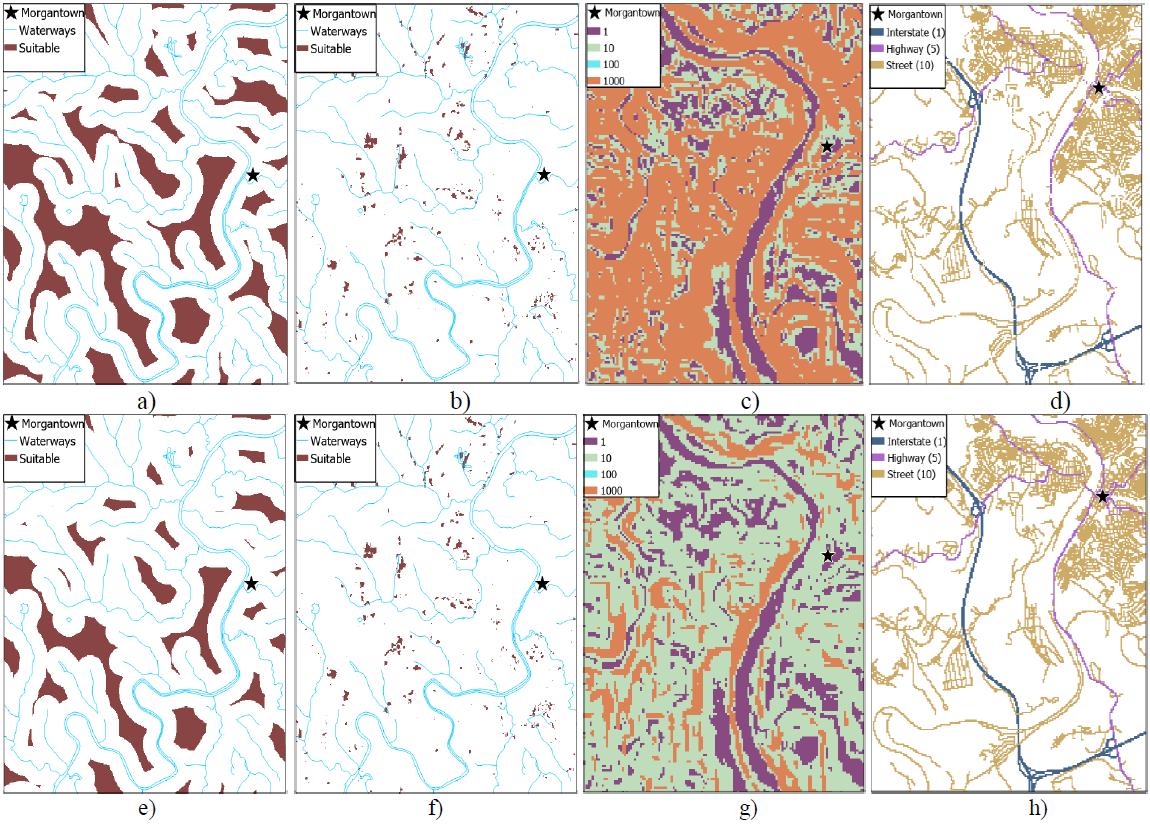
05
A multiple-criteria decision analysis
2020
Developed a raster-based GIS suitability model to identify optimal landfill locations in Monongalia County, West Virginia. The project integrated hydrology, land cover, slope, road access, and travel-cost criteria in ArcGIS Pro to screen candidate sites, compare model scenarios, and evaluate environmental and transportation tradeoffs for spatial decision-making.
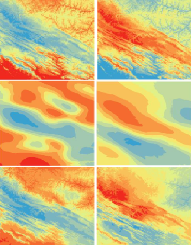
05
Modeling climate surface
2020
Compared multiple GIS-based approaches for modeling climate surfaces across the Central Appalachian region, including global polynomial interpolation, elevation-based linear regression, ordinary Kriging, and empirical Bayesian Kriging regression. The project used NOAA climate station data, DEM-derived elevation, exploratory spatial data analysis, and PRISM-based error mapping to evaluate how different interpolation methods predict precipitation and temperature across complex terrain.